December 28/29th, 2006
Boulder, CO - Extreme Wet Snow Event
General Storm Evolution |
Radar Animations |
Snowfall Total Maps |
Satellite Imagery
Thursday December 28 |
Friday December
29 |
| |
| Return Home |
| Return to Analysis
Page |
| |
|
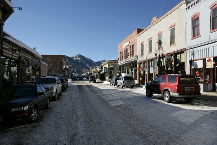
Boulder, Colorado
Winter Storm |
|
|
Boulder |
Boulder |
|
| |
Chase Target: Boulder, Colorado and
Eastern Colorado Plains
Flying Time: 2.5 hours
Miles Traveled: 2100+
Storm Rating First Half 
Storm Rating Second Half - No Stars - Bust |
| |
|
Chase Forecast: |
|
|
The decision to chase this storm
was based on the prospect of seeing "true" blizzard conditions.
Unfortunately, in the end, we ended up with a major wet snow event but missed
the blizzard conditions (lesson learned on chasing in Colorado). No regrets
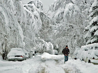
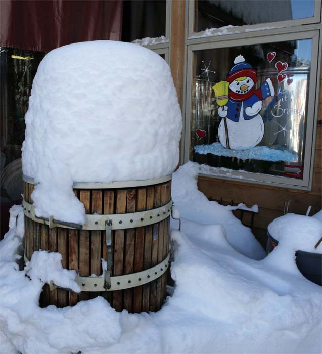
though. I was able to experience one of the most extreme wet
heavy snowfall events of my lifetime. So not all was lost! The
photographs
from this chase are amazing. The snow was like paste...sticking to
everything. Portions of Boulder received 14" of white gold. Tree limbs
and power lines were downed by the weight of the snow. I had a blast
driving around Boulder on the evening of the 28th and into the morning hours of
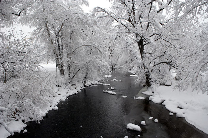
the 29th. I spent more than an hour walking around one of the city parks.
The parks in Boulder have a lot of streams, bike paths, and hiking trails making
for some incredible snow viewing opportunities.
The next day I had
planned on traveling to the Plains of Colorado but was never able to get
there. The state closed all of the roads. As much as I tried to
get through it was impossible. So I ended up missing the much bigger event
to the south and east. This was a major lesson learned. Having never
lived in the Central Plains (and I was warned ahead of time by on-line posters
but failed to listen)
I didn't realize how quickly conditions would deteriorate. Apparently
faster than the State of Colorado could keep up with! So we were left
stranded on the wrong side of the storm. Thankfully the wet snow event
made the trip well worth the time and energy.
In order to get to
Boulder we had to drive to
St Louis,
Missouri (which is about 3 hours
away) and then catch a flight to
Denver.
We chose
Frontier Airlines. GREAT CHOICE! They had
The Weather Channel on the plane!
Live
DirectTV. This was my first experience with this airline and it won't
be the last. Friendly and no-drama (just the way I like it). One of
my bags was even overweight and they let it slide. We would then rent a
car and drive to
Boulder. We
had hoped that the GPS Unit would work in Colorado. It did work but
unfortunately it was not programmed for that state. We were left hanging
dry at 10 p.m. at night. Soooo anyone who has grown accustomed to using a
GPS knows that life without one is exciting. It is especially exciting
when you don't know where you.
Thankfully I had printed out the
MapQuest
instructions to
Boulder.
Otherwise I guess we would still be driving around the
Denver International Airport. We
would later purchase a
Garmin StreetPilot C330 Unit from Best Buy (best decision of the trip -
HIGHLY recommend this unit). One forgets what
life was like before GPS.The
zone forecast, from the
National Weather Service, was for the
Denver/Boulder area to get heavy snow on Thursday Night and Friday and then a
second round of snow on Friday Night into Sunday. I figured Boulder would
receive more snow than Denver so made reservations at a hotel in the downtown
area of that city. I was surprised by the size of Boulder. I thought
it would be a much larger city. I was impressed with it none-the-less.
It seems like a great place to live. Scenic, with beautiful hills and
mountains to the west. I even had some camera problems on Thursday Morning and
was able to find a nice camera
store near the hotel. Everyone was helpful and nice. So Boulder gets
an A+ for hospitality!
My thoughts on Boulder was that they would have a
nice wet snow that might accumulate to 8 inches or more. That forecast
worked out nicely. Parts of the city received 14"+ of heavy, white,
frozen, pasty snow! BEAUTIFUL to say the least. Make sure you check
out the
photographs in the gallery. I can only dream of events like this back
home.
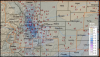
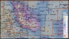
Map of travel
|
|
|
|
|
 |
|
Forecast Map
December 24, 2006 |
|
 |
|
Forecast Map
December 25, 2006 |
|
Forecast Map
December 26, 2006 |
 |
|
Forecast Map
December 27, 2006 |
|
|
|
|
 |
|
Forecast Map
December 28, 2006 |
|
 |
|
Forecast Map
December 29, 2006 |
|
Forecast Map
December 30, 2006 |
 |
|
Forecast Map
December 31, 2006 |
|
|
|
|
|
|
Thursday, December 28th
This was S day (snow day).
After getting a goods nights rest (something that was lacking during the
Peoria,
IL Winter Storm Chase) I was ready for some action. It appeared that most
of the snow would fall during the late afternoon and overnight hours. I
had some time to kill during the morning hours so I ended up playing tourist in
Boulder. I spent part of the day scouting out places to photograph once
the snow started. I found several nice parks - Central Park being one
of them. There were a lot of trails that would end up making nice
paths for photographs later in the evening. One thing about boulder is
that if you drive west you are going to go UPHILL and fast! Some steep
terrain in that city.
The precipitation started to move in during the early afternoon hours.
It first started out as a light drizzle and a few raindrops and then increased
steadily as the hours past. Mostly rain fell in the City of Boulder during
the early and mid afternoon hours. We drove about 20 minutes to the south and
found the rain changing to
snow. Slowly the snow level lowered and by late afternoon it was all snow
in Boulder. The snowflakes increased in intensity and size as the sun set
on Boulder. Before long the snowflakes were as large as quarters and some
were larger than that! Pretty impressive. It did not take long to
see 1-2 inch per hour rates in the city.
Moderate to heavy snow fell into the early morning hours. Tapering off
around 1 or 2 in the morning. I took photographs from 6 p.m. until
Midnight. At one point the snow was so wet and the flakes were so large that it was almost like slush.
I ended up pretty wet while trying to take photographs in one of the local
parks. Thankfully the temperature was not very cold. It was
nothing less than a Winter Wonderland around the City of Boulder. The
roads became snow packed quickly. Many roads were not being plowed and in
some areas the snow was so deep that I don't believe I would have wanted to be
on them without four-wheel drive. |
| |
| |
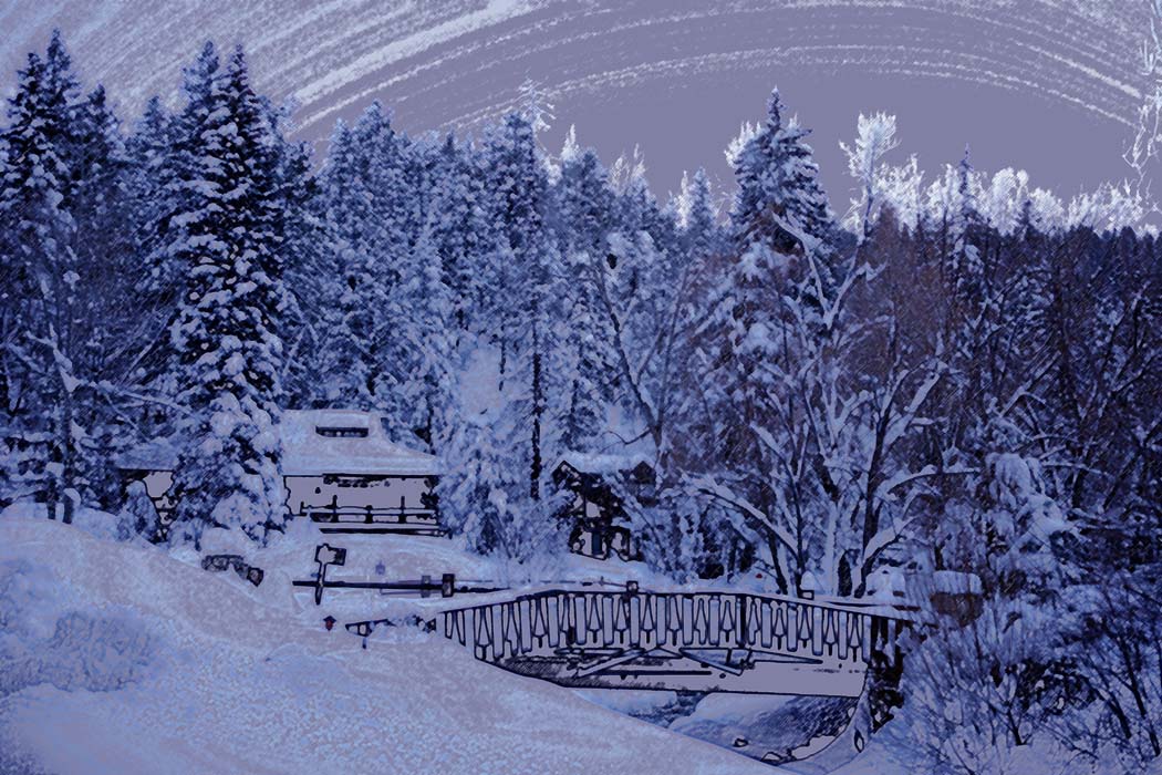
Friday, December 29th
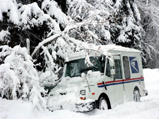
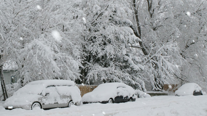
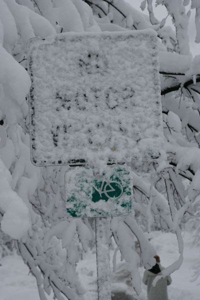
Needless to say the experience in Boulder was amazing. Waking in the
morning brought an INCREDIBLE site. Something that was akin to a Hollywood
Movie. Spectacular
scenes of
snow covered trees,
automobiles,
signs, houses, and everything in between. I have witnessed a lot of
nice snowstorms in my lifetime but this event definitely ranks as the number one
wet snow event. Well worth the trip to Colorado.
Unfortunately this is where the chase takes a turn...and not a good turn.
We made attempts to travel east from the Denver area. The roads were
closed across almost all of Eastern Colorado. Even though the snow had
ended and the roads seemed to be okay...it didn't matter. Closed is
closed. We waited for a number of hours - hoping - that they would open
again. They did not. We made some attempt to travel south and then
east but that didn't work out either. I should have listened to the advice
of some of the online weather community when they tried to warn me about
sticking to one area. If I had to do it over again I guess I would
have traveled to Eastern Colorado on Thursday...before the heavy snow fell.
I would have missed the big Boulder wet snow event...had I done that. So
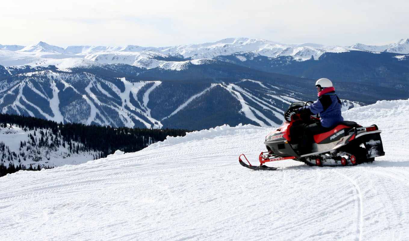
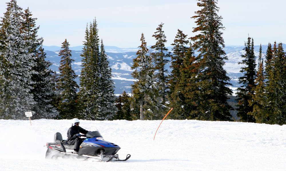
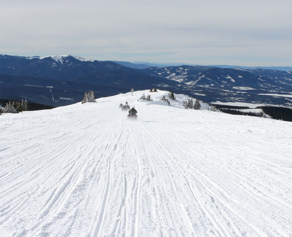
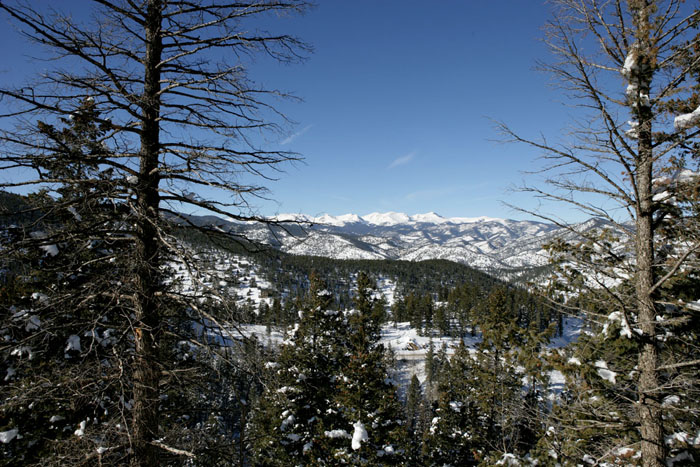
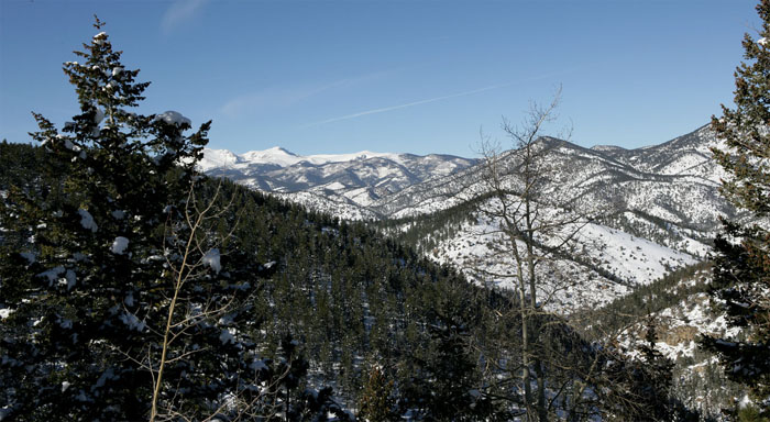
thus is life! I can't say that I left disappointed. I ended up going
snowmobiling 1
2
3 (check out the
view) in the Evergreen Region of
Colorado. This area had
received over 20 inches
of snow from the system that moved through the Denver/Boulder area.
Absolutely BEAUTIFUL area and
here
(be sure and click on the links for a photos I took of that area). If you
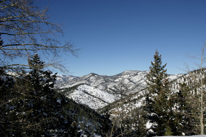
ever get a chance to visit then make sure you travel the
Squaw Pass Road.1
2 This
road will take you through the mountains and into
Idaho Springs.
Breathtaking scenery. Make sure you
get gas
though before you head into the hills...ummm someone forgot to fill the SUV up
before we headed out. I won't mention names but if I looked in the mirror
I would see the guy. :) Also check out Idaho Springs and if you love
to snowmobile then check out the
Winter Park area. We traveled there on Saturday. Unfortunately
this area was hit by an avalanche a few days after we left. A number of
cars were trapped under the snow on the same road we traveled. Thankfully nobody was killed. There are some extremely steep banks in that
region and when they are covered with snow it makes it a bit dangerous.
There were several small avalanches while we were in the area. Something
to keep in mind if you are adventuresome.
|
|
|
| |
| |
| December
26th - January 1st Precipitation Totals |
| |
 |
|
December 26th Precip
Total Amounts |
|
 |
|
December 27th Precip
Total Amounts |
|
 |
|
December 28th Precip
Total Amounts |
|
 |
|
December 29th Precip
Total Amounts |
|
|
| |
December 30th Precip
Total Amount |

December 31st Precip
Total Amount |
January 1st Precip
Total Amount |
|
| |
 |
|
24 Hour Precip Total Ending 7 a.m.
December 27th |
|
 |
|
24 Hour Precip Total Ending 7 a.m.
December 28th |
|
 |
|
24 Hour Precip Total Ending 7 a.m. December 29th |
|
 |
|
24 Hour Precip Total Ending 7 a.m.
December 30th |
|
|
|
|
24 Hour Precip Total Ending
7 a.m.
December 31st |
24 Hour Precip Total Ending
7 a.m. January 1st |
|
| |
|
|
|
Radar Animations and
Images |
|
|
|
|
| |
|
|
|
|
|
|
| |
| METAR DATA |
| |
|
KDEN METAR Dec
28 |
KDEN METAR Dec
29 |
|
Graphic Meteogram - Dec 28
Dec 29th |
| |
| AREA FORECAST
DISCUSSIONS FROM BOULDER/DENVER NWS |
| |
| 12/25-26 Denver, Colorado, NWS Area Forecast Discussions |
| 12/27 Denver, Colorado, NWS Area Forecast Discussions |
| 12/28 Denver, Colorado, NWS Area Forecast Discussions |
| 12/29 Denver, Colorado, NWS Area Forecast Discussions |
| 12/30 Denver, Colorado, NWS Area Forecast Discussions |
| |
| SHORT TERM
FORECAST FROM BOULDER/DENVER NWS |
| |
|
12/28 Denver, Colorado, NWS Short Term Forecast |
|
12/29 Denver, Colorado, NWS Short Term Forecast |
|
12/30 Denver, Colorado, NWS
Short Term Forecast |
| |
| ZONE FORECAST FOR
THE BOULDER AREA |
| |
| 12/28-30 Denver, Colorado, NWS
ZONE FORECAST |
| |
| |
| 500 mb Maps.
December 26th through January 1st |
500mb Map
December 26th |
500mb Map
December 27th |
500mb Map
December 28th |
500mb Map
December 29th |
|
|
|
500mb Map
December 30th |
500mb Map
December 31st |
500mb Map
January 1st |
|
|
|
|
Storm Prediction Center Mesoscale Discussions |
| |
|
|
| |
|
|
| |
| |
| Maximum and
Minimum Temperatures |
| |
 |
|
Dec. 27th Max/Min Temperatures |
|
 |
|
Dec. 28th Max/Min Temperatures |
|
 |
|
Dec. 29th Max/Min Temperatures |
|
 |
|
Dec. 30th Max/Min Temperatures |
|
|
| |
| |
 |
|
Dec. 27th Max/Min Temperature Map |
|
 |
|
Dec. 28th Max/Min Temperature Map |
|
 |
|
Dec. 29th Max/Min Temperature Map |
|
 |
|
Dec. 30th Max/Min Temperature Map |
|
|
| |
| Upper Level
Four Panel Maps.
December 12th through December 16th |
| |
| |
 |
|
12/26/06 00z
4 Panel
Winter Maps |
|
 |
12/26/06 12z
4 Panel
Winter Maps |
|
 |
|
12/27/06 00z
4 Panel
Winter Maps |
|
 |
|
12/27/06 12z
4 Panel
Winter Maps |
|
|
| |
| |
 |
|
12/28/06 00z
4 Panel
Winter Maps |
|
 |
12/28/06 12z
4 Panel
Winter Maps |
|
 |
|
12/29/06 00z
4 Panel
Winter Maps |
|
 |
|
12/29/06 00z
4 Panel
Winter Maps |
|
|
| |
 |
|
12/30/06 00z
4 Panel
Winter Maps |
|
 |
12/30/06 12z
4 Panel
Winter Maps |
|
 |
|
12/31/06 00z
4 Panel
Winter Maps |
|
 |
|
12/31/06 00z
4 Panel
Winter Maps |
|
|
| |
| |
|
Satellite Images --
NOAA |
| |
December 28th-29th
Satellite Animation |
December 29th-30th
Satellite
Animation |
| |
 |
|
12/26/06
Satellite Image 00z |
|
 |
12/26/06
Satellite Image 12z |
|
 |
|
12/27/06
Satellite Image 00z |
|
 |
|
12/27/06
Satellite Image 12z |
|
| |
 |
|
12/28/06
Satellite Image 00z |
|
 |
12/28/06
Satellite Image 12z |
|
 |
|
12/29/06
Satellite Image 00z |
|
 |
|
12/29/06
Satellite Image 12z |
|
| |
 |
|
12/30/06
Satellite Image 00z |
|
 |
12/30/06
Satellite Image 12z |
|
 |
|
12/31/06
Satellite Image 00z |
|
 |
|
12/31/06
Satellite Image 12z |
|
| |
| |
| Sea
Pressure Analysis |
| |
 |
|
12/28/06
Satellite Image 00z |
|
 |
12/28/06
Satellite Image 06z |
|
 |
|
12/28/06
Satellite Image 12z |
|
 |
|
12/28/06
Satellite Image 18z |
|
| |
 |
|
12/29/06
Satellite Image 00z |
|
 |
12/29/06
Satellite Image 06z |
|
 |
|
12/29/06
Satellite Image 12z |
|
 |
|
12/29/06
Satellite Image 18z |
|
| |
 |
|
12/30/06
Satellite Image 00z |
|
 |
12/30/06
Satellite Image 06z |
|
 |
|
12/30/06
Satellite Image 12z |
|
 |
|
12/30/06
Satellite Image 18z |
|
| |
| |
|
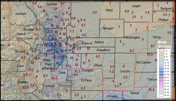
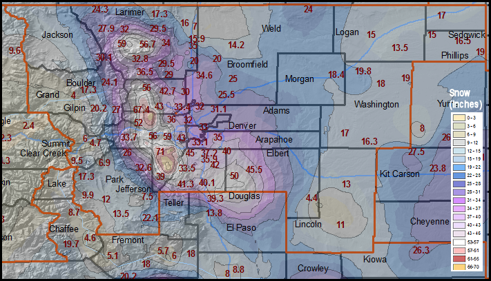
Location of Heavy Snow/Ice Areas --
NWS Maps |
| |
Snowfall and Ice Totals (the storm I chased)
Image provided by
Denver/Boulder, NWS |
Snowfall and Ice Totals for both storms
Image provided by
Denver/Boulder, NWS |
| |
|
Top of Page |
|
|
|
Back to Weather Photography Home Page |
| |
|
Page design inspired by cimss.ssec.wisc.edu |


